Exploring the route of Ice Age floods: Geologic treasure hunt runs from Missoula to Oregon
There were dry falls that dwarfed those at Niagara, ripple marks like those on a sandy beach, immense piles of gravel far up the slopes of mountains and much more.
Standing atop Steamboat Rock, 800 feet above the Columbia River in the high desert country of eastern Washington, we tried to imagine floodwaters rising 200 feet above our heads moving at 65 mph.
The stop was one of several six Billings friends and I made in mid-May on a driving tour from Missoula to Astoria, Oregon, on the track of a series of monster Ice Age floods.
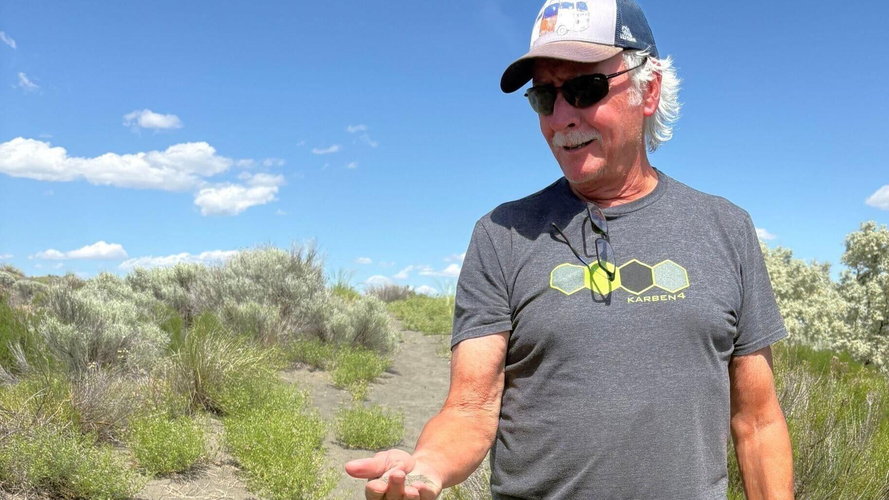
Our expedition leader was George Moncure, who had a geology-related career before he answered a higher calling and opened a brewery in Billings. Since retiring from the beer business about 10 years ago, he has led countless one- or two-day outings, most of them involving hiking and rocks, in Montana and surrounding states, plus some longer excursions.
Under his guidance, various members of our group — ages roughly between 65 and 75 — have stood on top of an extinct volcano near Big Timber, climbed enormous fins of red sandstone just over the Wyoming-Montana state line south of Billings and examined thousands of petroglyphs and pictographs in the pueblo canyons of southern Utah.
Our 10-day flood tour, though, involved more marvels and breathtaking sights than all our previous expeditions combined. There were dry falls that dwarfed those at Niagara, ripple marks like those you see on a sandy beach, but 30 feet high, immense piles of gravel far up the slopes of mountains and much, much more. The floods were so monumental that they inspired David Alt, an otherwise sober-minded geologist at the University of Montana, to publish a book titled “Glacial Lake Missoula and Its Humongous Floods.”
During the last Ice Age, from roughly 18,000 to 13,000 years ago, when all but the highest mountain peaks in British Columbia were covered by thousands of feet of ice, giant glaciers periodically crept south into the mountain valleys of northwestern Montana and northern Washington and Idaho. Many dozens of times, the leading edge of one such glacier would dam the Clark Fork River where it meets Lake Pend Oreille, near Sandpoint, Idaho.
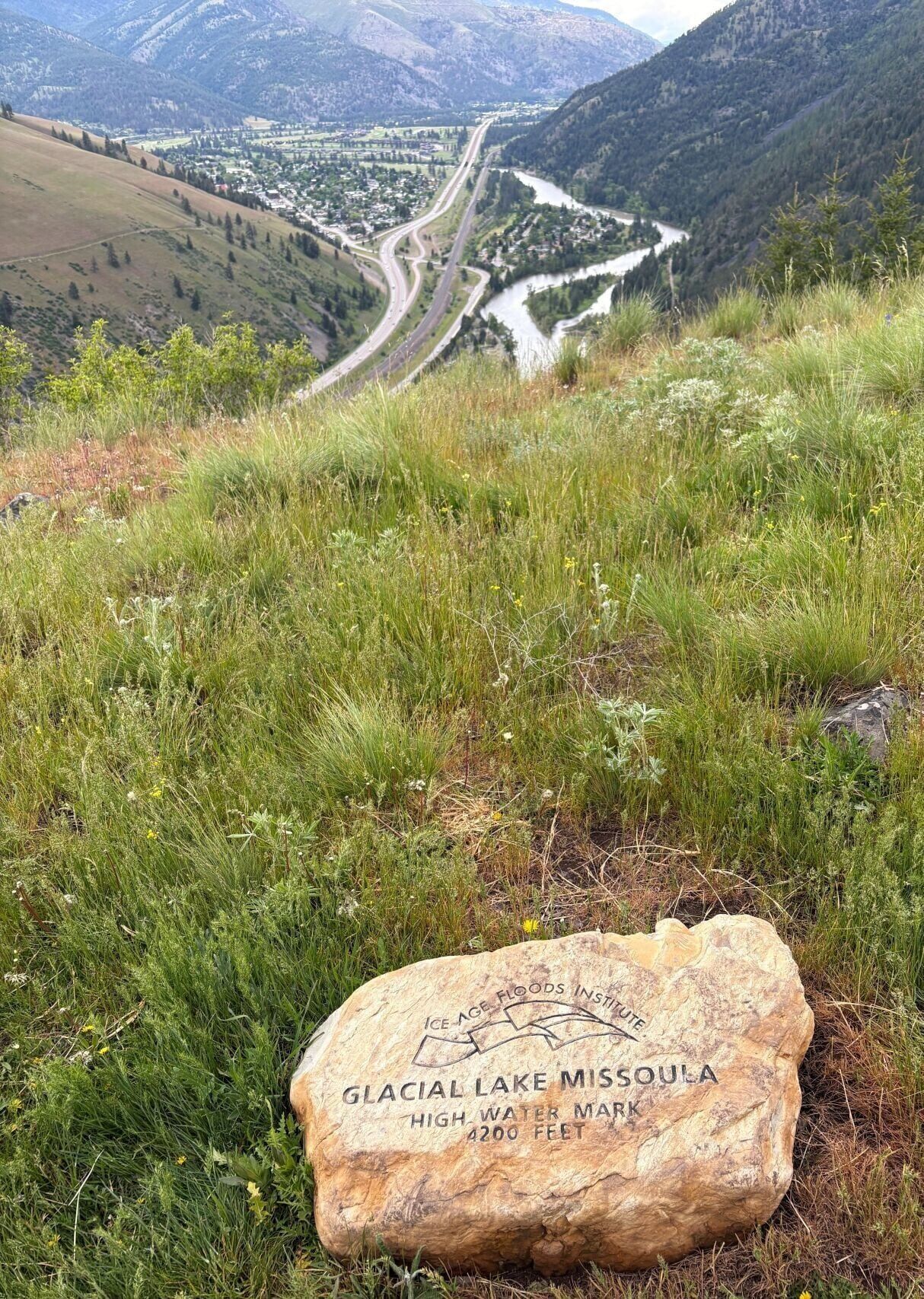
A rock monument marks the highest point of Lake Missoula, overlooking the Clark Fork River.
Over time, the dammed river would create a lake that filled not just the Clark Fork Valley but the Swan, Flathead and Bitterroot valleys. At its greatest extent, Lake Missoula held as much water as Lakes Erie and Ontario combined. Eventually, the impounded water would break through the dam and thunder across Idaho, Oregon and Washington. At a depth of 1,000 feet and traveling as fast as 65 mph — a flow 10 times greater than the volume of all the rivers in the world today — it would drain that vast lake in just two to four days.
This happened again and again for thousands of years, creating a landscape that still leaves visitors speechless, struck with awe. It was this landscape we had come to explore.
The tour officially began late on the afternoon of Saturday, May 16, when we all made our way to the “M” on the side of Mount Sentinel overlooking the University of Montana campus. From there we continued up about 400 feet to a small stone monument created by the Ice Age Floods Institute. Engraved on it are the words: “Glacial Lake Missoula, high water mark, 4,200 feet.”
Geologists know it's the high-water mark because the western face of Mount Sentinel is neatly marked with horizontal bands, shorelines of all those Ice Age lakes. Though we couldn’t really make them out on our climb, the lines are starkly apparent in the right light, or after a dusting of snow. During our hike, by the way, we experienced periods of rain and sleet, alternating with brief windows of sunshine. It was difficult, on a flood tour, to complain of a little moisture.
The next day we headed north on Highway 93 (with a stop near Arlee at the Garden of One Thousand Buddhas), then up Highway 200, following the Clark Fork River north and west. Our destination was Markle Pass north of Perma, the best place from which to see what are known as the Camas Prairie ripples. These are basically giant gravel bars deposited by the floods, up to 35 feet high and 300 feet from crest to crest.
Like the shorelines on Sentinel, the ripples were hard to discern with the naked eye, given the light conditions that day. But the wonders of iPhone photography did bring them out quite noticeably. Even then, however, we could not grasp their “outlandish scale,” as Alt put it.
The Camas Prairie ripples played a key role in the understanding of the Lake Missoula Floods. In the early 1920s, geologist J Harlen Bretz, after studying the scoured-out scablands of eastern Washington, concluded that nothing but a flood of unimaginable proportions could have created that landscape. He was ridiculed by his colleagues, for whom it was an article of faith that the observable world was modified by slow, imperceptible forces.
As Alt explained, geologists then considered it “nothing less than heresy to invoke a catastrophic explanation for a geologic event.” Bretz, who could not come up with a source of the floods that underlay his theory, would eventually be vindicated, mostly thanks to the work of another geologist, Joseph Pardee. In 1942, with the help of aerial photography, Pardee recognized the Camas Prairie ripples for what they were.
“I marvel at his perception,” Alt wrote. “No one else in the world had even imagined such things as giant ripples in 1942.” From there, other geologists pieced together the story of the glacial dams and the periodic floods.
Near the end of his life, Bretz was awarded the highest honor in the field of geology, the Penrose Medal. “All my enemies are dead,” he told his son afterward, “so I have no one to gloat over.” For our little band, Bretz was the hero, the animating spirit, of our expedition.
Leaving Camas Prairie, we crossed into Idaho, with plans to hike to the top of a ridge overlooking Lake Pend Orielle, to try to visualize the glacial dam that created Lake Missoula. But we were behind schedule (1,000 Buddhas), and the weather was still changing constantly, with intervals of heavy rain, so we continued on to Sandpoint. We stopped along the way at a roadside kiosk devoted to the Ice Age floods, and there we read this astounding fact: an iceberg that calved off the glacial dam had carried a 31,107-pound meteorite all the way from Canada to the Willamette Valley in Oregon.
We headed out the next day in the direction of Grand Coulee Dam. The weather was perfect, with blue skies and temperatures in the low 60s, and would remain pleasant for the rest of the trip.
The key to the rest of our expedition was the interplay of those recent floods with volcanic eruptions millions of years ago, which deposited black volcanic basalt up to three miles deep across the vast Columbia Basin of Washington and Oregon. Almost all volcanic rock, whether it explodes out of a volcano or oozes up through vents to the surface, is basalt.
As we drove down Grand Coulee, looking at high, steep canyon walls of basalt columns surrounded by a barren, stripped-down landscape, George observed: “Looks quite different from Montana, doesn’t it? Montana was the water tank; this is the drain pipe.”
At the Grand Coulee Dam visitors center we were treated to a well-done, 15-minute documentary about the great floods. We also picked up a glossy brochure outlining the Ice Age Floods National Geologic Tour. We were not aware that there was a formal counterpart to our somewhat haphazard tour.
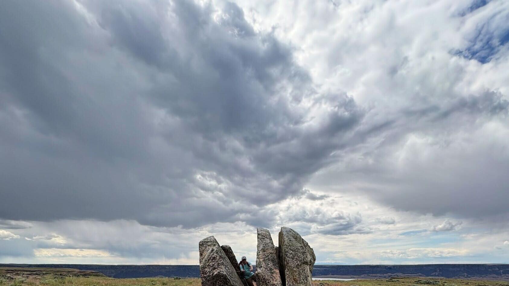
From the dam we made our way to the previously mentioned Steamboat Rock, an 800-foot-high rectangular butte of basalt that was left standing when the great floods washed away everything around it. The feature looks something like House Rock on the Gallatin River, blown up to absurd proportions. Our five-mile round-trip hike to the top of the butte was probably the hardest of the tour, but we were rewarded with magnificent vistas in every direction.
More evidence of the floods sat on top of the butte — a couple of Winnebago-size boulders (now cracked into a cluster of smaller fragments) — dropped there, like the meteorite, by icebergs.
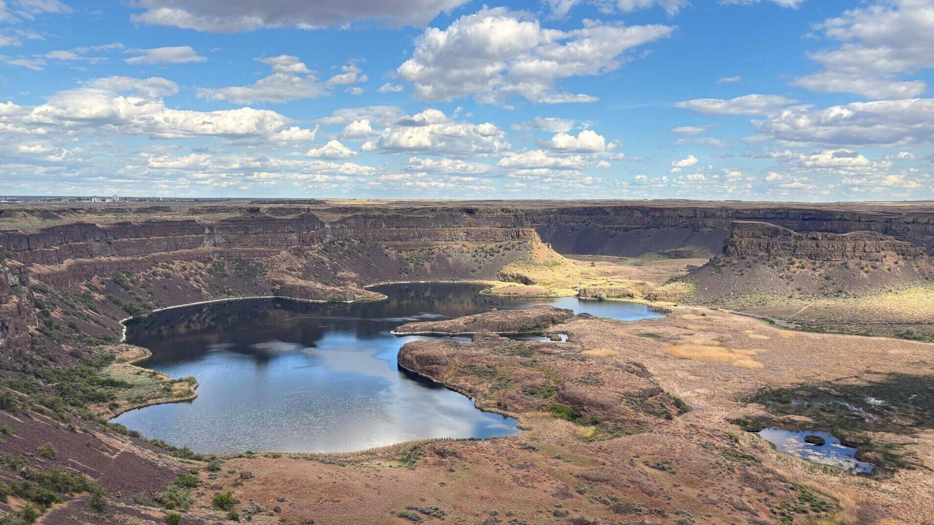
Our destination the next day was the Dry Falls at Grand Coulee, an extinct waterfall three and a half miles wide and 400 feet high, four times larger than today’s Niagara Falls. Now it is a colossal box canyon littered with monolithic hoodoos of basalt fragments that had tumbled down from the towering cliffs.
The following day found us hiking through black sand dunes, made up of weathered basalt, said to be the largest field of basaltic dunes in the world. Nearby were the Drumheller Channels, a series of immense valleys bordered by soaring walls of basalt columns, some of them twisted into phantasmagorical shapes.
On tap on for Day 6 were Palouse Falls, where the Palouse River drops 200 feet over a sheer cliff. The scene is beautiful beyond words, but again, the geology of it is more wondrous still. In his book, Alt gets almost testy here, apparently fed up with the Lilliputian scale of the contemporary world. He refers to the modern Palouse River as “hardly more than a creek,” and points out that it drops over the cliff “into a ridiculously oversized plunge pool,” way too big for “the puny modern stream.” The short-lived Ice Age rivers roared over the top of the whole vast bowl now punctuated by the puny Palouse.
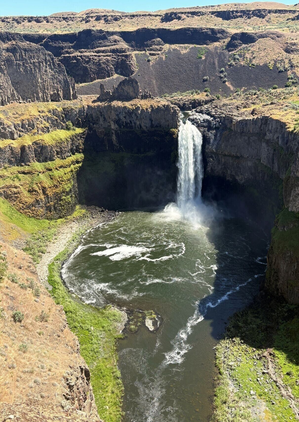
The plunge pool below 200-foot-high Palouse Falls is oversized thanks to the Ice Age floods that once poured over the surrounding cliffs.
That afternoon, high on a hillside overlooking the famous Wallula Gap of the Columbia River, we climbed up to the Twin Sisters, basalt pillars created by the same forces that carved out Steamboat Rock. Here we had one of our few disappointments: thoughtless visitors have defaced the Twin Sisters with graffiti, made even worse by the knowledge that the name of the features is derived from an important piece of Native American lore.
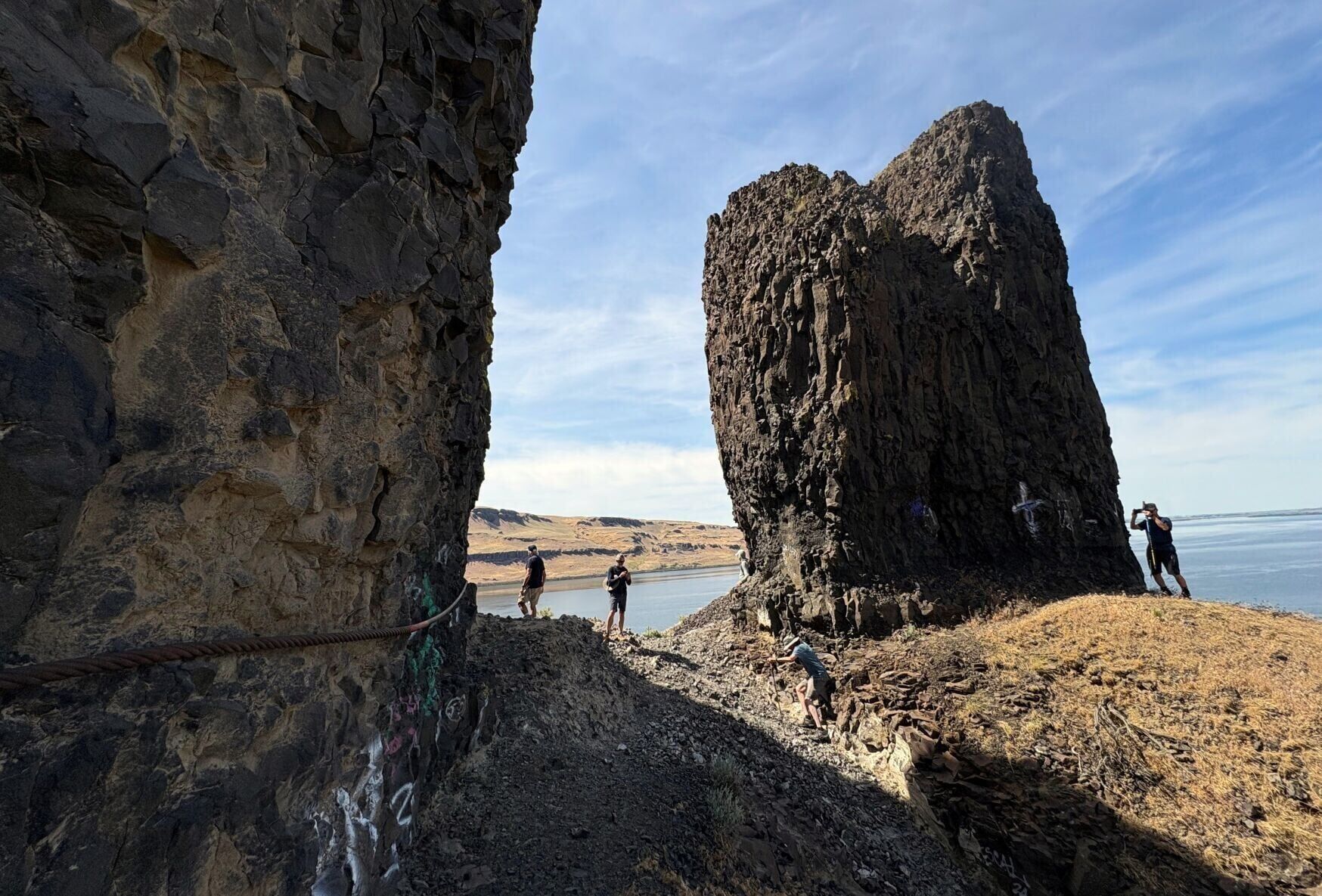
Graffiti, visible at the bottom left, has marred the iconic Twin Sisters basalt pillars overlooking the Wallula Gap of the Columbia River.
Pushing on to Astoria, Oregon, the next morning, we stopped at Beacon Rock, the inner core of a volcano that erupted rather recently, just 57,000 years ago. Its top sits 850 feet above the Columbia, meaning it was, during the floods, under several hundred feet of water. It was only a mile to the top, following a zigzagging trail, much of it with guardrails, but we felt it on legs that had already put in 35-some miles of hiking in the past six days.
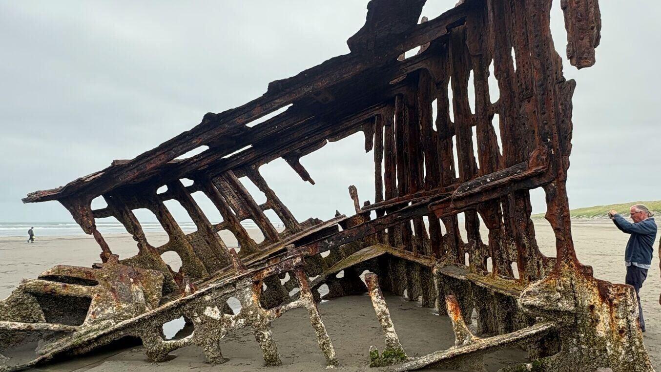
Astoria, near where the Columbia disgorges into the Pacific Ocean, was a bit anticlimactic. We could have gone to Cape Disappointment State Park, on the Washington side of the Columbia and the westernmost point of the river, but seeing the ocean was enough. During the last Ice Age, so much of the world’s water was stored in the continental ice sheets that the shoreline near Astoria was 40 miles or so farther out to sea than it is now. And unless you were to go in a submarine and explore the giant trench carved into the ocean floor by the great floods, there was nothing more to see but the sea.
It had been an exhilarating trip, with a fair amount of strenuous hiking for a bunch of old men. We were not so very old, though. In geological terms, we barely registered as infants. There was also this: minutes before our departure from Missoula we were in the parking lot of a motel when a rugby player with a bruised face and a black mullet came up to our party.
He was in town for the annual rugby tournament hosted by the Missoula Maggots, and he wanted to know if we by any chance belonged to one of the teams. Our first reaction was to laugh out loud at the absurdity of the question, given our age and condition. But the more we thought about it, even in spite of the likelihood that he was hung over and possibly suffering from a concussion, we took it as a compliment.
And though we continued to laugh about the question right through the end of the trip, I believe it did put a spring in our step, and it definitely lightened our spirits.