5,000+ acre Moose Fire still uncontained, new small fires spark after lightning
UPDATE: August 20, 2026 at 9:57 a.m.
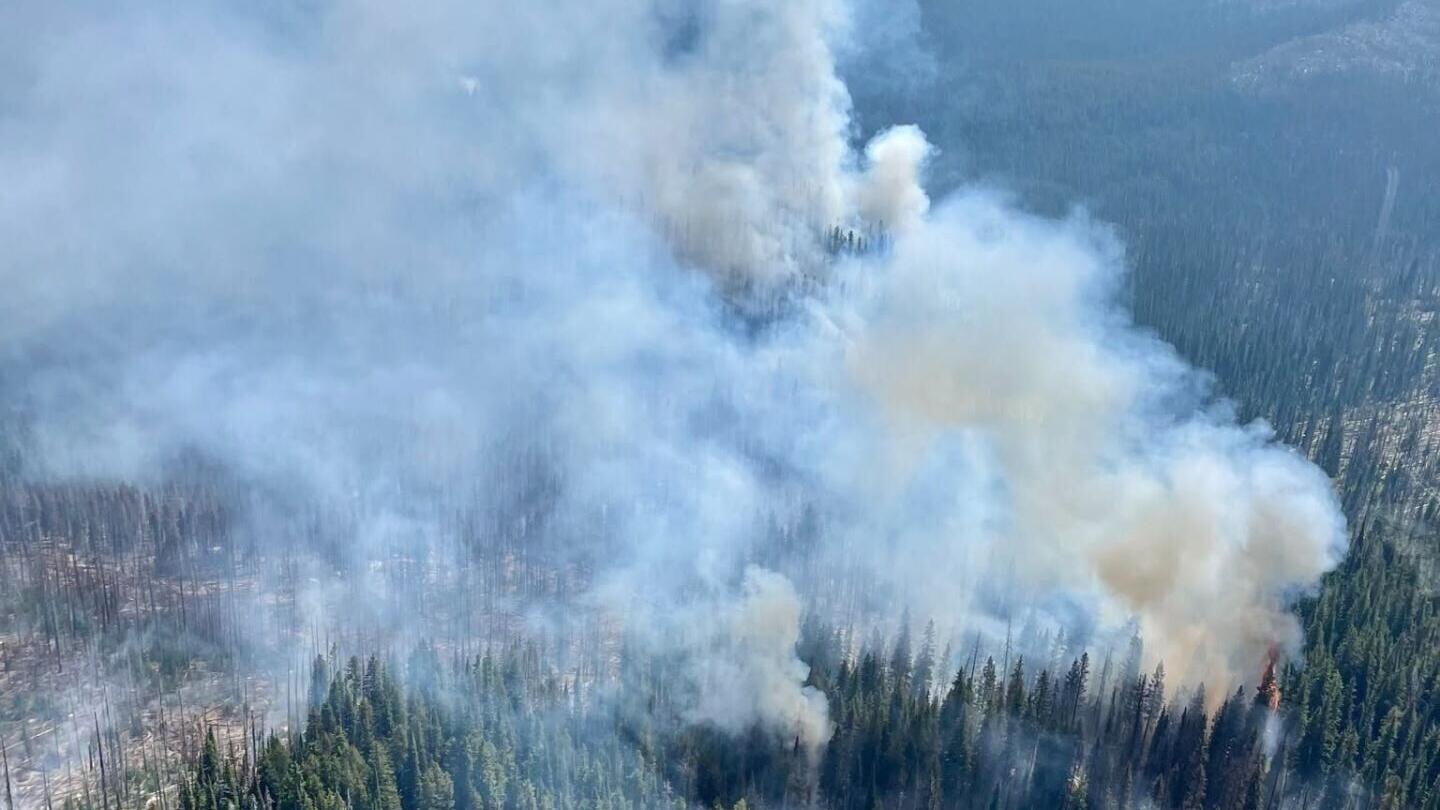
Courtesy of the Beaverhead-Deerlodge National Forest
UPDATE: August 20, 2026 at 9:57 a.m.
The Moose Fire is still burning around 5,965 acres, according to an update from the Beaverhead-Deerlodge National Forest. It remains 6% contained.
The forest service said tht the fire grew 83 acres on Wednesday along the northern and western portions of the fire's perimter.
The Frog Pond Basin area is still under a "RED" evacuation order, and the Granite County Sheriff's Office reminded residents and visitors not to enter the area.
UPDATE: August 19, 2026 at 8:03 a.m.
The 5,892-acre Moose Fire has reached 6% containment, according to an update from the Beaverhead-Deerlodge National Forest.
The Gila Las Cruces Type 3 Incident Management Team took over command of the Moose Fire on Tuesday, the forest service said. The fire had minimal growth on Tuesday, "though heat remains in heavy dead and down fuel loading along the perimeter."
"Strategic priorities include public and firefighter safety, Frog Pond, Lower Ross Fork, Kaiser Lake and Moose Lake private land and infrastructure, grazing allotments, and natural resources," the forest service said.
A "RED" evacuation order for Frog Pond Basin is still in effect.
UPDATE: August 18, 2026 at 10:32 a.m.
The Moose Fire, 5,892 acres in size, still has zero containment, according to an update from the Beaverhead-Deerlodge National Forest.
Fire crews are expected to continue strengthening the fire's perimeter today.
"Firefighter safety remains central to operations, with crews continually assessing conditions and engaging where work can be completed safely and effectively," the forest service said.
A "RED" evacuation order for Frog Pond Basin is still in effect.
UPDATE: August 17, 2026 at 9:37 a.m.
The Moose Fire is still burning 5,678 acres with no containment as of Monday, according to an update from the Beaverhead-Deerlodge National Forest. Incident command said that structure protection is still the priority.
"Despite recent rainfall, residual heat from smoldering fuels remains within the fire perimeter and could produce flare-ups as conditions dry," the Western Montana All-Hazards Type 3 Incident Management Team said. "Changing weather, steep terrain, and the potential for lightning caused fires continue to pose hazards to firefighters. Crews are balancing these risks with opportunities to strengthen handlines, protect structures, and extinguish remaining heat that could threaten established lines."
Thunderstorms expected this afternoon and evening may increase fire activity or start new fires.
UPDATE: August 14, 2026 at 1:34 p.m.
A round of lightning strikes on Thursday afternoon started several new fires, which firefighters worked to contain through the following night. The 5,678-acre Moose Fire did not grow in size or containment.
In a Friday update from Discover Bitterroot National Forest, the organization said the Moose Meadow 1 and 2 fires were both extinguished, as was the quarter-acre Coal Ridge Fire near Painted Rocks.
Firefighters also extinguished or contained fires near Connor and Downing Mountain.
UPDATE: August 13, 2026 at 11:33 a.m.
The Moose Fire is now burning around 5,678 acres with zero containment, according to the daily update from the Beaverhead-Deerlodge National Forest. Incident command said today firefighters will continue to hold and strengthen containment lines.
Wetter conditions incoming may moderate fire behavior, the forest service said, but higher winds or additional lightning are possible from storms.
Two additional fires broke out on Wednesday night, according to the Bitterrot National Forest, called the Moose Meadows 1 and 2 fires. Both were lightning-caused, and crews from Missoula are responding.
UPDATE: August 12, 2026 at 9:37 a.m.
The Moose Fire grew to 5,524 acres and is still 0% contained, according to a Wednesday morning update from the incident commander.
The commander said the fire was most active on its north side, where it grew past two previously burned areas. He said crews spent time working on structure protection near upper Ross Fork Road and constructing fire lines in other areas.
UPDATE: August 10, 2026 at 10:15 a.m.
The Moose Fire has grown to 4,314 acres with no containment, according to an update from the Beaverhead-Deerlodge National Forest shared by the Granite County Sheriff's Office.
The lightning-caused fire grew on the north and south sides of its footprint over the weekend, the forest service said.
"Fire danger will remain near critical, and dry fuels and wind could lead to rapid fire spread and challenging firefighting conditions," the forest service said.
UPDATE: August 6, 2026 at 2:29 p.m.
Residents in Frog Pond Basin are directed to immediately evacuate due to the Moose Fire, according to the Beaverhead-Deerlodge National Forest. The U.S. Forest Service said deputies are going door-to-door to inform residents.
The fire is 1,002 acres in size and 0% contained.
For more information and a full list of road closures on U.S. Forest Service land, visit the Beaverhead-Deerlodge National Forest social media page.
GRANITE COUNTY, Mont. - The Granite County Sheriff's Office (GCSO) said in a social media post that a "YELLOW" evacuation warning was being issued for residents in the Frog Pond Basin Community. A "YELLOW" warning is not an official evacuation order, rather advanced notice that evacuations may be ordered, according to GCSO.
GCSO said the Moose Fire has not crossed Ross Fork Creek, but the "YELLOW" warning was put in place "out of an abundance of caution."
"Residents and or property owners are WARNED, that a current or projected hazard associated with emergency in this area may require immediate evacuation," GCSO said. "A YELLOW evacuation warning is advance notice that this area may be evacuated."
GCSO said no evacuation order is in place at this time, but residents can sign up to receive notifications online.
Article originally posted August 5, 2026 at 7:33 a.m.